

What our team said...
Dave Frost - Operations Manager
"Our aspiration to go paperless on everything we do means this is just an ideal platform for us. Using the app means that we can have our site forms created on there for the guys, risk assessments, task briefings and all the other bits of information we need.
What’s great about the system for us is that it’s really quick. The guys can just access what they need to on the forms out on site and get this information back to us in the office really quickly and without using paperwork."


Project
Earthworks Inspections
Duration
Ongoing


GeoAccess
Key Stats
Number of Users
Assets
Value of Assets
Background
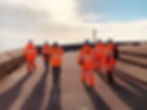
GeoAccess Ltd are an IRATA - certified technical rope access and Civil Aviation Authority approved commercial drone company.
They have implemented Censite across their examination teams working throughout the UK, digitising previous paper systems and streamlining processes.
With Teams working remotely, Censite empowers GeoAccess with realtime data that can be shared with all project stakeholders instantly.
How is Censite Used?
Digital Documentation - GeoAccess use the Site Pack as a bulletin board forinformation that needs to get to their teams quickly. All required info is added to Censite and available for the remote teams instantly
Site Forms - All forms, reports, safety and quality reporting have been digitised on Censite. The Inspection Teams complete all forms digitally through their device onsite, feeding real time data back to the Project Team.
Briefings - Daily Task Briefings and Tool Box talks are completed digitally by the Inspection Teams on a daily basis.


